
Cruach na Rad [Crownarad] [Crowanrudda]
Good walks are even better shared.
Overview
Cruach na Rad [Crownarad] [Crowanrudda]
Nestled in the stunning Argyll and Bute region of Scotland, Cruach na Rad might not be the highest peak around, but it certainly offers a rewarding adventure for those seeking both tranquillity and breathtaking vistas. Standing at 611 meters, this Marilyn invites hikers with its moderate difficulty and manageable trails, making it a perfect day out for families and seasoned trekkers alike.
Geology
Cruach na Rad is predominantly composed of schist and granite, resulting in its rugged appearance that attracts not just hikers but also geology enthusiasts. These ancient rocks tell the story of the Earth's dynamic history, layered with fascinating formations that have stood the test of time.
Routes
The most popular route to summit Cruach na Rad is the Northwest Ridge Route. This route is relatively straightforward, allowing walkers of all abilities to embrace the mountain's beauty. At approximately 5.2 kilometers in length, it takes about 2.5 hours to complete, depending on your pace. Just make sure to pause every now and then to catch your breath and admire the surrounding landscape—it’s worth it!
Summit Features
Upon reaching the summit, you'll be greeted by a modest cairn. It's the perfect spot to plop down with your packed lunch, reflect on your accomplishments, and perhaps strike a pose for that all-important social media pic.
Terrain Type
Expect a variety of terrain types as you ascend. The path is predominantly grassy with rocky outcrops, but don’t forget to tread carefully in the boggy patches—slippers are for dance floors, folks!
Views
And what views you will see! From the summit, the vista extends to the shimmering waters of Loch Long and out towards the Firth of Clyde. On a clear day, the majesty of Ben Lomond graces the horizon, making it a photographer's dream. The best seasons to take in these sights are spring and autumn, when nature shines in its vibrant glory.
Hazards
As with any outdoor adventure, be aware of the potential hazards. Sudden weather changes can sneak up on you; after all, Scotland's moods are as unpredictable as the Highlands' sheep! Ensure you have appropriate clothing, sturdy footwear, and a healthy respect for the sometimes slippery terrain.
Nearby Summits
For those looking to extend their adventure, consider tackling nearby peaks such as Ben Bowie (664 meters) and Dumgoyne (427 meters), both providing their unique challenges and views—just remember to practice your quick maths skills for those elevation calculations!
Access
You're in luck when it comes to access! The nearest parking along the A814 road provides ample space for a few vehicles. Helensburgh is the closest town, only 8 km away, offering all the amenities you might need, including cafes and shops. If you'd prefer to travel by public transport, several bus services connect you from Helensburgh to the starting point.
Facilities
Cafes and public toilets in Helensburgh allow you to refuel both your body and soul before or after your climb. Don’t forget to grab a cream scone or two—hiking fuels!
History
The name 'Cruach na Rad' translates to 'heap of the radiance', a nod to its prominent place in the landscape. The mountain holds a special place in local folklore, steeped in myths and tales that make this hike not just a physical journey, but a cultural one.
So lace up those boots, grab your walking stick, and hit the trails of Cruach na Rad for a delightful day of adventure and exploration!
Happy hiking!
Explore routes near Cruach na Rad [Crownarad] [Crowanrudda]
Public walks starting within 80 km of this hill. Nearby does not mean a route reaches the summit; check its map and access before setting out.
Route planning notes
These notes describe possible approaches, not verified navigable routes or permission to cross land. Check current paths, local access rules and conditions before setting out.
Northwest Ridge Route
A straightforward ascent that begins from the A814 road, making it accessible for a range of hikers.
Make a day of it, together
Find someone to share the walk with, or organise a day out along a route you like.
Hill facts and local notes
Classifications
Elevation
493m
1,617 ft
Prominence
209m
Coordinates
54.6545, -8.5027
G676786
OS Map
10
At the Summit
The summit is marked by a modest cairn, providing a perfect spot for a well-deserved snack while soaking in panoramic views.
Terrain & Geology
Cruach na Rad primarily consists of schist and granite, contributing to its rugged appearance and rich habitat. The geological structure offers fascinating insights into the region's ancient formations.
Views & Scenery
Breathtaking views of Loch Long, the Firth of Clyde, and the surrounding mountains, including the majestic Ben Lomond.
History & Heritage
Name Origin
The name 'Cruach na Rad' translates to 'heap of the radiance' in Gaelic, hinting at its glowing presence in the landscape.
Historical Significance
This mountain has significance in local folklore and is part of the rich cultural history of the Argyll region.
Getting There & Facilities
Check current local access restrictions, parking rules and transport timetables before travelling. These notes do not confirm public access to the summit.
Parking
The nearest parking is available along the A814 road, slightly to the north of the starting point, with space for several vehicles.
Public Transport
Regular bus services operate to nearby towns, with the closest stop being in Helensburgh. Check local timetables for routes and schedules.
Nearby Facilities
In Helensburgh, you'll find cafes, shops, and public toilets, so stock up before tackling the climb.
Safety Information
Known Hazards
- Potential for sudden weather changes, uneven terrain, and the risk of slipping in boggy areas.
General Safety Tips
- Check weather conditions before setting out
- Carry appropriate clothing and equipment
- Let someone know your planned route
- Take a map, compass, and GPS device
- Carry emergency supplies: food, water, first aid kit, torch
Hills
Some common questions about the hills answered
Are there group walks up Cruach na Rad [Crownarad] [Crowanrudda]?
Many walkers use Walkmates to join or organise walks with others. You can check for group walks around Cruach na Rad [Crownarad] [Crowanrudda] through the maps
Are there other walkers around Cruach na Rad [Crownarad] [Crowanrudda]?
Activity varies by location and time, but Walkmates lets you see whether others have shared walks or shown interest in this area. Find other people through the walking friends search walking friends for Cruach na Rad [Crownarad] [Crowanrudda] search or of course create your own walk for Cruach na Rad [Crownarad] [Crowanrudda]
Can I organise a walk to Cruach na Rad [Crownarad] [Crowanrudda]?
Yes. If there aren’t any walks listed already, you can create a walk and make it available for others to join.
If you're signed up to Walkmates, you can create a walk to Cruach na Rad [Crownarad] [Crowanrudda].
How do I find a walk up this hill?
There are often multiple ways to walk this hill, depending on experience and route preference. Walkmates helps you explore walks and routes that others have shared.
Can I suggest a new route up Cruach na Rad [Crownarad] [Crowanrudda]?
Yes. You can suggest or create routes to share with others. Walkmates focuses on the social side of walking, so routes are used to help people organise walks and explore areas together, rather than as detailed navigation tools or route libraries.
Other uses really appreciate knowledgeable walkers sharing their routes. Share your favourite route to Cruach na Rad [Crownarad] [Crowanrudda] here
The is an error or something incorrect about this hill. How do I let you know?
We always strive to keep the information on Walkmates as accurate as possible. If you find an error, please let us know through the contact form and we'll aim to correct it as quickly as possible
Community Discussion
Comments
Location
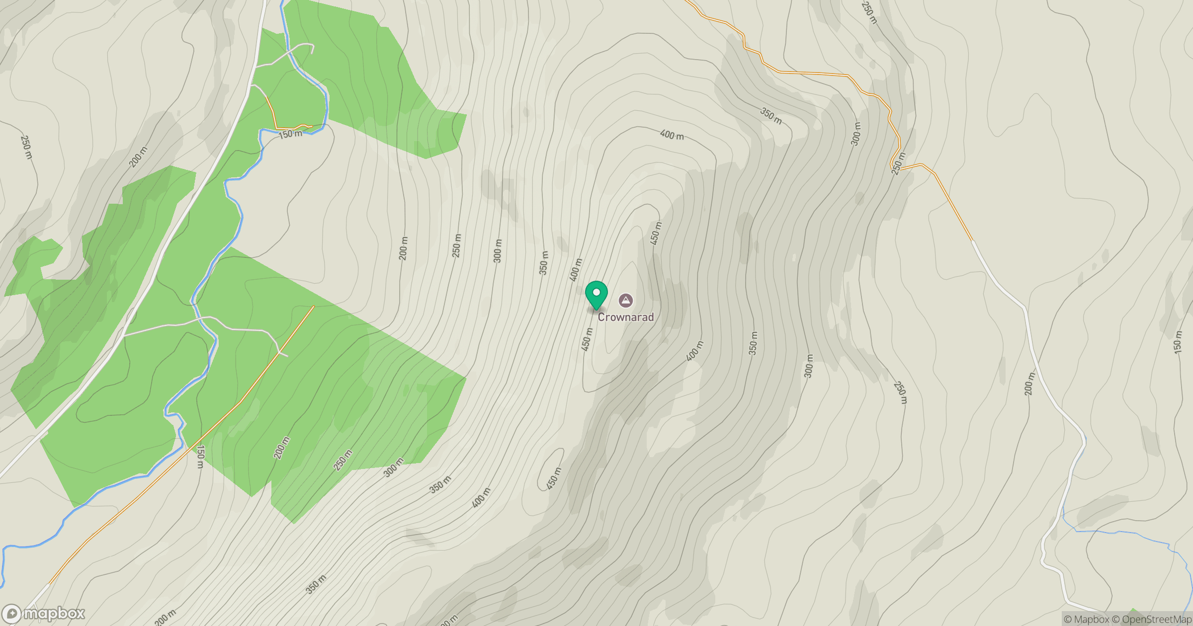
Grid reference: G676786
View on OpenStreetMapOpens a map in a new tab, centred on the hill.
Hills within 30 km
Straight-line distance, not a walking route or confirmation of access.
No comments yet. Be the first.